
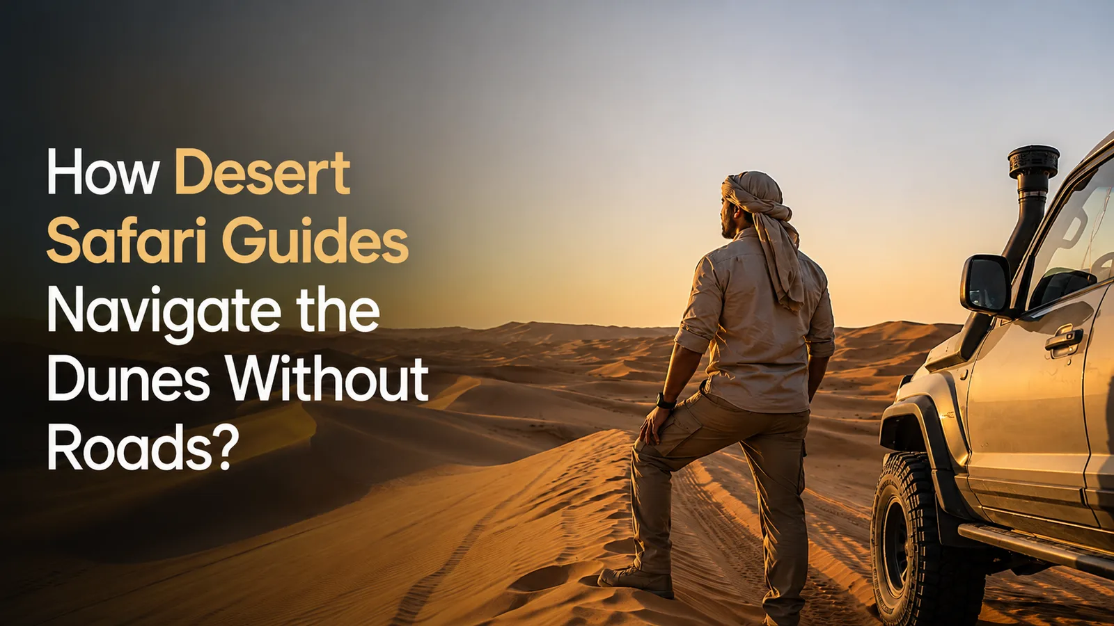
The desert appears endless. There are no road signs, no marked lanes, and often no visible landmarks. Yet experienced desert safari guides confidently lead quad bike tours, dune buggy adventures, and off road expeditions across vast landscapes without getting lost.
Many visitors wonder how a desert safari guide can navigate thousands of acres of shifting sand dunes when roads simply do not exist. The answer lies in a combination of traditional navigation techniques, modern technology, environmental awareness, and years of practical experience.
Desert safari navigation is a highly specialised skill developed through training, field experience, and a deep understanding of desert terrain. Professional guides learn how to read sand dunes, interpret wind patterns, utilise GPS tracking systems, and apply dead reckoning techniques to safely guide tourists across challenging environments.
For companies such as Quad Bike Tourism, navigation expertise is one of the most important factors in delivering safe and enjoyable desert adventures. Whether operating a quad bike, dune buggy, or support vehicle, guides must constantly assess terrain conditions, weather patterns, and route options.
This guide explores exactly how desert safari guides navigate without roads and why these skills remain essential even in the age of satellite technology.
What Is Desert Safari Navigation?
Desert safari navigation is the process of safely travelling through sand dunes and remote desert terrain without relying on traditional road infrastructure.
Unlike driving on highways or urban streets, desert navigation requires guides to create routes based on changing environmental conditions. Sand dunes move over time due to wind activity, making yesterday's tracks unreliable today.
A professional desert safari guide must continuously evaluate terrain, identify safe crossing points, and maintain orientation throughout the journey. This skill is especially important during quad bike safaris where riders often travel through remote dune fields far from established access roads.
Desert navigation combines geographical knowledge, vehicle control, environmental awareness, and emergency planning into a single operational discipline.
How Do Desert Guides Navigate Without Roads?
Desert guides navigate without roads by combining GPS technology, dead reckoning, terrain analysis, landmark recognition, compass navigation, and years of local knowledge.
While many tourists assume GPS performs all navigation tasks, experienced guides understand that technology can fail. Sandstorms, battery issues, equipment damage, or communication problems can affect electronic navigation systems. For this reason, every professional desert safari guide develops multiple backup navigation methods. The most successful guides can determine their location using natural terrain features even when GPS devices are unavailable.
Why Are Sand Dunes Difficult to Navigate?
Sand dunes create one of the world's most challenging navigation environments. Unlike mountains or forests, dunes constantly change shape due to wind activity. A strong Shamal wind can significantly alter dune formations and erase vehicle tracks within hours. The desert also lacks permanent reference points. A guide may travel for kilometres while seeing only sand dunes in every direction.
This creates several navigation challenges:
- Visibility can be reduced during sandstorms.
- Tracks disappear quickly.
- Landmarks are limited.
- Terrain conditions change daily.
- Vehicle performance varies depending on sand consistency.
Because of these factors, desert safari navigation requires specialised training and continuous situational awareness.
How Do Desert Safari Guides Read Sand Dunes?
One of the most fascinating navigation skills involves learning how to read sand dunes like a map. Every dune contains valuable information about prevailing wind direction, terrain stability, and potential route options. A professional desert safari guide studies dune morphology to understand how the landscape has been shaped.
Windward slopes generally indicate the direction from which the wind is blowing. Slip faces reveal where sand is accumulating and where steep descents may occur. Guides use this information to predict terrain conditions ahead and identify safer travel routes. Reading sand dunes correctly reduces vehicle strain, improves fuel efficiency, and enhances passenger safety.
What Is a Barchan Dune and Why Is It Important?
Barchan dunes are crescent shaped sand dunes created by winds blowing predominantly from one direction. These distinctive formations serve as natural navigation markers throughout many desert regions. Experienced guides can determine prevailing wind patterns by observing the orientation of a barchan dune.
This information helps maintain directional awareness when travelling across large dune fields. Because barchan dunes follow predictable formation patterns, they become valuable reference points during off road desert route finding. Many desert safari guides learn to identify specific dune types early in their training because these formations provide critical navigational clues.
Do Desert Safari Guides Use GPS?
Yes, modern desert safari guides extensively use GPS tracking systems. GPS technology provides accurate positioning data, route recording, emergency communication support, and operational monitoring.
Most professional tour operators utilise advanced GPS equipment integrated with mapping software and emergency response systems. GPS tracking desert operations improve safety by allowing support teams to monitor vehicle locations in real time.
However, experienced guides never depend solely on GPS. Electronic devices can malfunction, lose signal, or suffer battery failure. As a result, guides maintain traditional navigation skills as essential backups. The best desert safari guides combine technology with practical field knowledge rather than relying entirely on digital tools.
What Is Dead Reckoning and Why Do Guides Use It?
Dead reckoning is one of the oldest navigation techniques still used today. Dead reckoning involves calculating a current position based on a known starting point, direction of travel, speed, and elapsed time. A desert safari guide uses dead reckoning when visibility becomes poor or electronic systems become unavailable.
For example, if a guide travels east for twenty minutes at a known speed, they can estimate their approximate location relative to their starting position. Although not as precise as GPS, dead reckoning provides an effective backup navigation method. Many professional desert guide navigation techniques incorporate dead reckoning as part of standard training programmes.
How Does Tire Pressure Affect Desert Navigation?
Many tourists are surprised to learn that tyre pressure is actually a navigation tool. Tire pressure sand riding techniques significantly affect vehicle performance on dunes. Reducing tyre pressure increases the contact area between the tyre and the sand. This helps distribute vehicle weight more evenly and improves traction. Proper tyre pressure allows guides to follow intended routes more accurately while reducing the risk of becoming stuck. A poorly inflated quad bike may struggle to climb dunes or maintain directional control.
For this reason, experienced guides carefully adjust tyre pressure before entering deep sand environments. Understanding tyre pressure management is considered a fundamental aspect of desert safari navigation.
How Do Quad Bike Guides Find Their Way Back in the Desert?
Many visitors ask how do quad bike guides find their way back in desert environments after travelling far into remote dune systems. The answer involves route memory, GPS tracking, terrain recognition, and environmental awareness. Professional guides develop strong mental maps of operating areas through repeated experience. They learn to recognise unique dune formations, ridgelines, and geographical features that may appear insignificant to tourists. Many guides can identify specific routes based on subtle terrain characteristics. Combined with GPS route logging and dead reckoning techniques, this knowledge enables safe and efficient returns even in complex dune networks.
What Happens If GPS Fails During a Desert Safari?
GPS failure is rare but always considered during operational planning.
Professional operators train guides to continue navigation using alternative methods.
These may include:
- Compass navigation.
- Dead reckoning.
- Landmark identification.
- Dune orientation analysis.
- Radio communication with support teams.
- Emergency route protocols.
Desert survival orientation training prepares guides for situations where electronic systems become unavailable.
This redundancy ensures passenger safety under all operating conditions.
How Does Wind Influence Desert Navigation?
Wind is one of the most important environmental factors affecting desert travel. The Shamal wind frequently impacts desert regions and can rapidly alter dune formations. Strong winds may erase tracks, reduce visibility, and change terrain conditions. Experienced guides constantly monitor wind behaviour before and during tours. Reading wind ripples on sand surfaces provides important information about prevailing wind direction and recent environmental changes. Many desert guide navigation secrets involve understanding how wind shapes terrain and influences route selection.
Why Is Desert Tour Guide Training So Important?
Desert tour guide training goes far beyond vehicle operation.
Professional training programmes cover:
- Navigation principles.
- Emergency response procedures.
- Vehicle recovery techniques.
- Terrain assessment.
- Weather monitoring.
- First aid.
- Risk management.
- Environmental awareness.
Guides learn how to navigate barchan dunes on ATV vehicles while maintaining passenger safety and operational efficiency. This combination of technical and practical skills separates professional operators from inexperienced drivers.
How Do Guides Keep Tourists Safe During Navigation?
Safety remains the highest priority on every desert safari. A desert safari guide continuously evaluates terrain conditions, vehicle performance, weather patterns, and rider capability levels. Guides select routes appropriate for participant experience and vehicle type. They maintain communication with support teams and monitor group positioning throughout the tour. Advanced planning ensures recovery resources remain available if required. Professional navigation directly contributes to safer desert adventures and improved customer experiences.
Why Is Local Knowledge More Valuable Than Technology?
Technology provides valuable support, but local knowledge remains irreplaceable. A GPS device can display coordinates. An experienced guide understands what those coordinates mean in practical terms. Local guides know which dunes become unstable after storms, where soft sand accumulates, and which routes provide the safest passage. Years of field experience allow guides to make informed decisions that technology alone cannot replicate. This combination of human expertise and technological support creates the safest and most effective navigation system available.
How Does Quad Bike Tourism Ensure Safe Desert Navigation?
At Quad Bike Tourism, professional desert safari guides combine advanced GPS tracking systems, proven navigation methods, and extensive local knowledge to deliver safe desert adventures. Every route is carefully planned and continuously assessed to ensure optimal safety and enjoyment. Guides understand sand dune morphology, tyre pressure management, dead reckoning principles, and emergency navigation procedures. This comprehensive approach allows visitors to experience the excitement of desert exploration while benefiting from expert leadership and operational safety standards.
Conclusion
Desert safari guides navigate the dunes without roads by combining traditional navigation skills with modern technology. They read sand dunes, analyse wind patterns, utilise GPS tracking systems, apply dead reckoning techniques, and rely on extensive local knowledge developed through years of experience.
The ability to navigate safely across constantly changing desert terrain requires far more than simply following a GPS device. Professional guides understand the science of sand dune morphology, the impact of wind systems such as the Shamal, and the vehicle dynamics that influence successful route selection.
Whether leading a quad bike adventure, dune buggy tour, or off road expedition, expert navigation remains one of the most important skills in desert tourism. It ensures safety, enhances the customer experience, and allows visitors to explore some of the world's most remarkable landscapes with confidence.